Located in Beibei District of Chongqing, Jinyun Mountain (缙云山) is a breathtaking destination with a rich history dating back millions of years. Formed during the “Yanshan Movement” 70 million years ago, the mountain is characterized by its lush greenery, swirling white clouds, and ever-changing atmospheric phenomena. Its name, “Jinyun,” refers to the vibrant interplay of red and white clouds that paint the skies during sunrise and sunset. This guide provides detailed directions, tips, and insights for completing the scenic 11-kilometer hiking trail that ascends 900 meters, taking 4-5 hours to complete.
Route Overview
The hiking trail is well-marked and divided into three sections, making it suitable for both experienced hikers and beginners. The journey combines fitness paths, mountain trails, and paved roads, with no off-trail hiking required. Access to the mountain is convenient via Chongqing’s rail and bus systems.
Route:
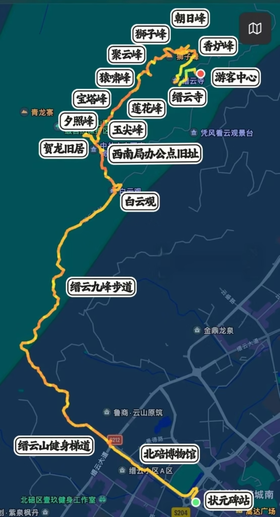
Light Rail Zhuangyuanbei Station (状元碑轻轨站) ➡️ Jinyun Mountain Fitness Steps (缙云山健身梯道) ➡️ Jinyun Nine Peaks Trail (缙云九峰登山步道) ➡️ Baiyun Temple (白云观) ➡️ Old Southwest Headquarters (西南部旧址) ➡️ Jinyun Nine Peaks (缙云九峰) ➡️ Scenic Area Exit ➡️ Downhill ➡️ Bus No. 518 to Beibei Station (北碚站)
Gear: Comfortable hiking shoes, water, snacks, sunscreen, and a camera for capturing the stunning views.
Best Time to Visit: Early morning or late afternoon to enjoy the sunrise or sunset views and avoid crowds.
Section 1: Zhuangyuanbei Station to Old Southwest Headquarters
1. Zhuangyuanbei Light Rail Station to Fitness Steps (1.2KM)
Start your journey at Zhuangyuanbei Light Rail Station (状元碑轻轨站, Exit 1C). From here, follow navigation to the Jinyun Mountain Fitness Steps (缙云山健身梯道), which is about a 15-minute walk (1.2 kilometers). The fitness steps are a 500-meter uphill staircase—steep but manageable. Take it slow to conserve energy for the rest of the hike.
2. Fitness Steps to Baiyun Temple (4.5KM)
At the top of the steps, you’ll find a platform with rest facilities. From here, follow signs to the Jinyun Nine Peaks Trail (缙云九峰登山步道). Shortly after, you’ll reach a fork in the trail—be sure to take the right path that leads to the paved road. This section is a gradual incline and relatively easy to walk. After the trail ends, you’ll need to walk another kilometer along the road to reach Baiyun Temple (白云观).
3. Baiyun Temple to Old Southwest Headquarters (0.8KM)
From Baiyun Temple, continue uphill along the mountain trail to the Old Southwest Headquarters (西南部旧址). This section is steeper and more physically demanding, with a climb of 800-900 meters. Take breaks as needed and enjoy the lush surroundings.
Section 2: Hiking the Jinyun Nine Peaks
4. Exploring the Nine Peaks (2KM)
The trail becomes more scenic and exciting as you begin climbing the Jinyun Nine Peaks (缙云九峰). The first five peaks are relatively close together and not very challenging, making it a pleasant start to this section.
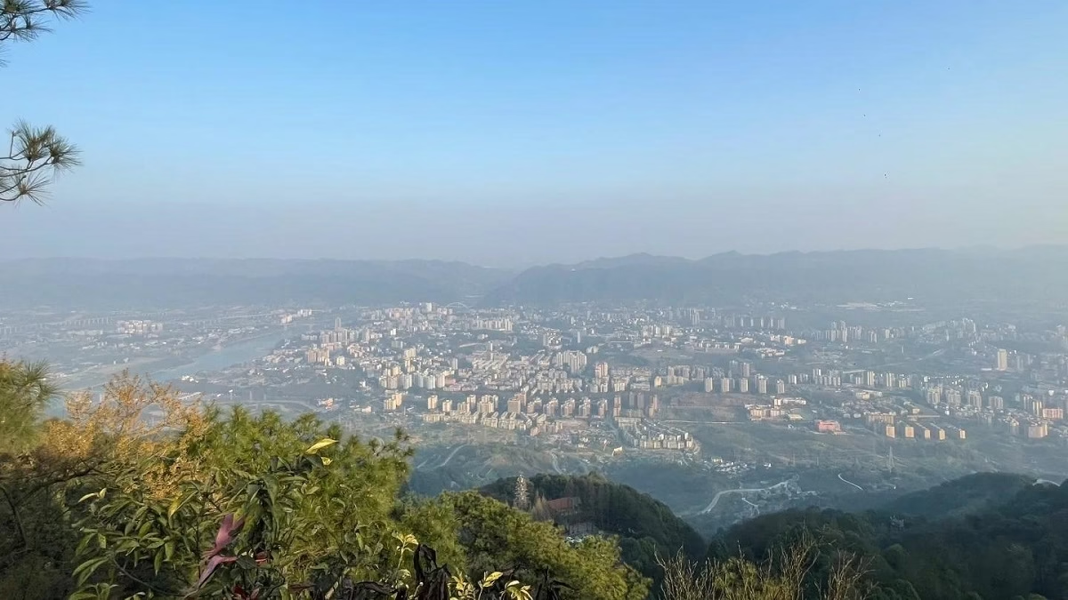
- From Juyun Peak (聚云峰) to Lion Peak (狮子峰): The trail becomes slightly longer and requires descending before ascending again. Lion Peak offers stunning panoramic views of Beibei District (北碚城区), making it a perfect spot for photos.
- Kalu Peak (卡炉峰): This is a prime location for watching the sunrise or sunset, with breathtaking views. Spend some time here to soak in the beauty.
- Incense Burner Peak (香炉峰) and Chaori Peak (朝日峰): The trail leads to these two peaks. However, Chaori Peak is undeveloped and currently inaccessible.
Section 3: Descending the Mountain
5. Nine Peaks to the Scenic Area Exit (3KM)
After completing the nine peaks, begin your descent. The trail passes by scenic spots such as Lovesick Rock (相思岩) and Jinyun Temple (缙云寺) before reaching the road leading to the visitor center. From here, you can choose to descend by cable car or bus, or continue on foot.
6. Visitor Center to Scenic Area Exit (2.7KM)
If you prefer to walk down, the trail to the scenic area exit is about 2.7 kilometers and mostly downhill. It’s a scenic route with plenty of opportunities to take photos.
Transportation Tips
Getting There:
- Light Rail: Take Chongqing Rail Transit to Zhuangyuanbei Station (状元碑轻轨站, Exit 1C).
- By Bus: After hiking, you can take Bus No. 518 or No. 520 from the scenic area to Beibei Station (北碚站).
Returning:
- Cable Car: If you prefer a quicker descent, take the cable car down from the visitor center.
- Bus: Buses from the visitor center run until 6:00 PM. Be sure to check the schedule to avoid long waits.